NSW Premier Gladys Berejiklian and her team are “extremely worried” about parts of the Mid North Coast, including Kempsey and Taree.
“It’s important for us to make sure we’re not taking our eye off the ball on any part of the State,” she told reporters on Monday.
“And, also, to make sure that we monitor weather conditions and rainfall, and also likely direction of where those peak river conditions are likely to be.”
Areas affected
“This is different to what we’ve experienced before; it is bigger than what we’ve experienced before.” – NSW Premier Gladys Berejiklian
Currently, severe weather warnings are in place for Northern Rivers, Mid North Coast, Upper Western and parts of Hunter, Central Tablelands, North West Slopes and Plains, Central West Slopes and Plains, Lower Western and Northern Tablelands Forecast Districts.
Other areas of NSW are on flood watch and given minor to moderate flood warnings.
On Monday, 151 school were closed due to damage and severe weather conditions. Twenty public schools stayed open with minimal supervision and 36 public schools were operational with some damage or impact recorded.
Hope 103.2 is proudly supported by
Record-breaking rainfall
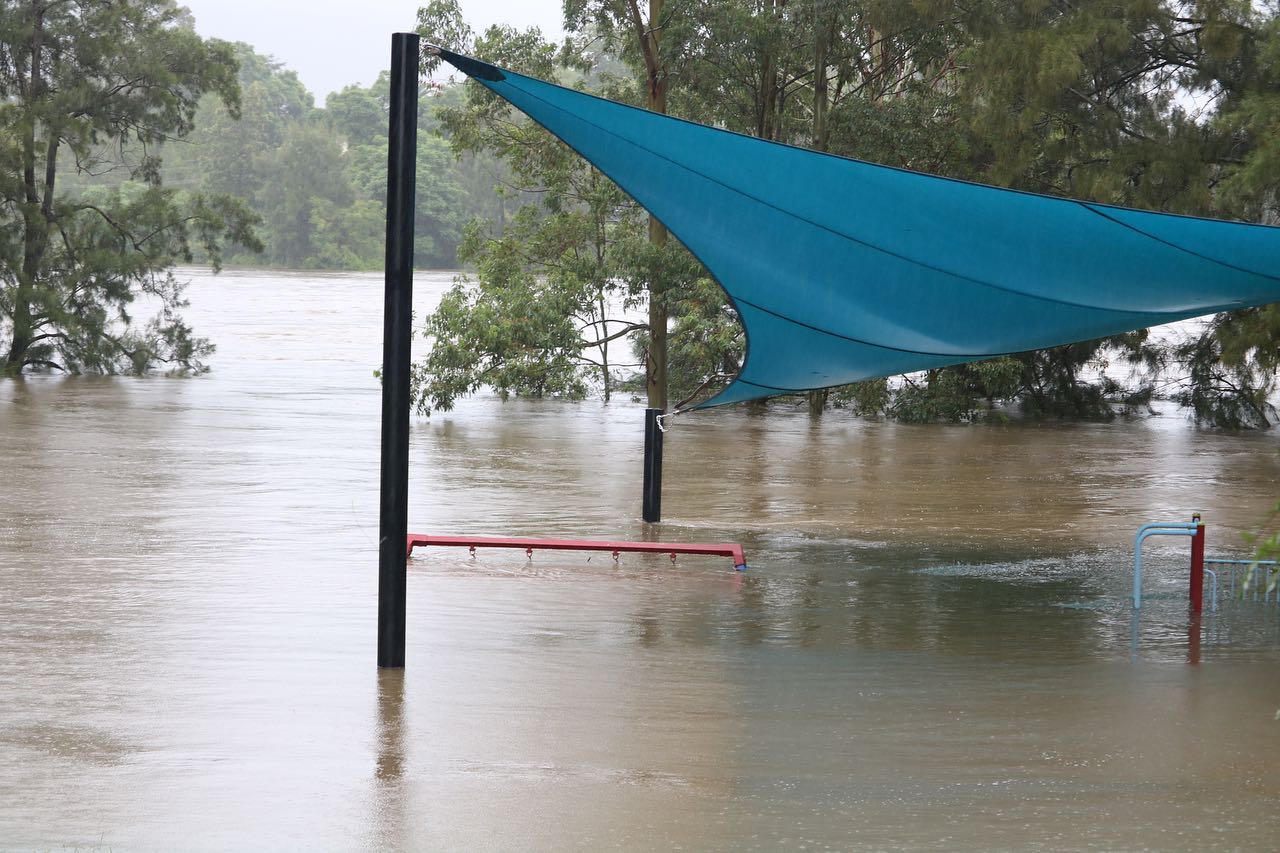
Some locations around Port Macquarie on the Mid North Coast saw almost 900mm in the last five days, including 883mm at Redoak and 880mm at Comboyne Public School, according to the Bureau of Meteorology.
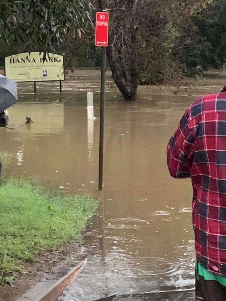
Some outstanding rainfall totals in eastern NSW during the last four days. Kempsey's 618.4mm (96 hours to 9am Monday) exceeds the town's previous MONTHLY record for March, which was 617.6mm back in 1894. Data for Kempsey goes back to 1882. pic.twitter.com/XTwQ5ID8IJ
— Ben Domensino (@Ben_Domensino) March 22, 2021
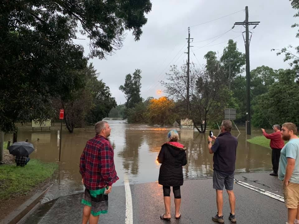
“What we’re going through now is not anything we’ve seen for at least 50 or 60 years,” Ms Berejiklian said.
“I’m told parts of the Mid North coast are experiencing a one-in-100-year event. So, this is different to what we’ve experienced before; it is bigger than what we’ve experienced before.”
Nelson Bay on the NSW Mid North Coast recorded 458mm of rain in three days, the highest ever three-day total since records began at that location in 1889, according to BOM.
What to do if affected
“If you don’t leave at the right time then you become more or less trapped by the waters,” – Former NSW SES Acting Commissioner Jim Smith
Those who have been impacted by the storms and floods are able to access support from the Federal Government under its Australian Government Disaster Recovery Payment (AGDRP).
Go to the SES website to stay up to date. If you need emergency help caused by the storm or flood, call 132 500, and for life threatening emergencies, call 000.
This provides one-off financial assistance to eligible Australians who have been adversely affected by the storms and floods.
The rate of AGDRP is $1000 per eligible adult and $400 per eligible child. Claims for this payment can be lodged with Services Australia for a period of up to six months.
Former NSW State Emergency Service (SES) Acting Commissioner Jim Smith said it is important that people listen to evacuation warnings from the SES.
“If you don’t leave at the right time then you become more or less trapped by the waters, then it takes the emergency services to come and rescue you, or you try and get out yourself and endanger your own life,” he told Hope 103.2.
However, he said it’s important that people not panic but keep informed by checking social media channels of emergency services and call the SES if they have concerns.
“The more information you have, the better you can make your assessments,” Mr Smith said.
“Knowing that you’re safe, your area is safe, is good; knowing that floodwaters may be coming towards you, gives you that time to make that informed decision.”

Two tips in preparing for a flood
“A good thing to always have in your home is a portable, affordable radio, battery powered.” – Former NSW SES Acting Commissioner Jim Smith
He offers two pieces of advice to help people prepare.
“A good thing to always have in your home is a portable, affordable radio, battery powered, that you can turn on because all the radio services are always trying to keep people informed,” Mr Smith said.
“And make sure your phone’s always charged because a phone’s a good source of information. That’s when people start to panic, when they lose that form of communication.”
The rain forecast is expected to continue until at least Wednesday. However, the State will need to remain on high alert even after that, according to the Premier.
“Sometimes, the peak can occur after the rain has stopped. So, sometimes, depending on where you are, you can experience those peak flood conditions post the rain stopping,” Ms Berejiklian said.
Mr Smith, who is also a member of Emergency Leaders for Climate Action, a group of former senior emergency service leaders with first-hand experience dealing with climate change impacts, believes that climate change will lead to more storms in the future.
“The increase in temperature does mean we’re going to have a lot more storms because of that higher increase in temperatures in the sea levels, so it means that we’re going to have a lot more storms,” he said.
On-air interviews
Port Macquarie
Listen: Journalist Ben Shuhyta spoke on Breakfast with Sam Robinson about the situation in Port Macquarie
Penrith
“While the rain is still falling… safety, in this time, that’s very much a priority,” – Federal Member for Lindsay Melissa McIntosh on the situation in and around Penrith
Listen: Federal Member for Lindsay that includes Penrith Melissa McIntosh spoke on Mornings with Katrina Roe, after 3000 people were evaculated from the area with the Nepean River expected to rise further
Flood Management Australia advocacy
Listen: Flood Management Australia’s Ian Dinham spoke to Drive host Ray Kington, saying that for the past 60 years FMA has been advocating for government policies and strategies to focus on reducing future flood losses rather than encouraging repeated repair and replacement of damaged buildings and infrastructure after floods
Hope News bulletin
Hear the latest from the Hope Newsroom.
Hope News is available weekdays 6am to 6pm, on-air and online.
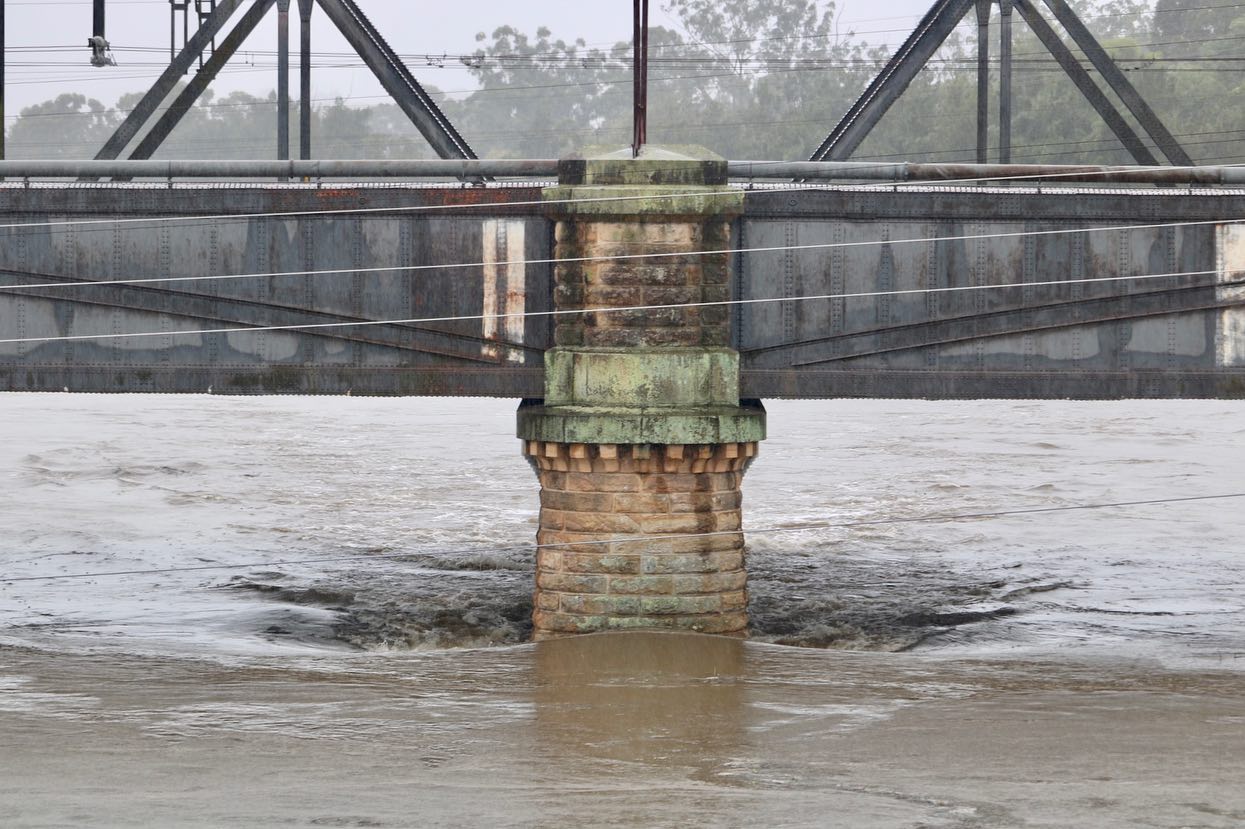
Article mages supplied by local residents: Tracy Middleton and Michelle De Rooy
Get daily encouragement delivered straight to your inbox
Writers from our Real Hope community offer valuable wisdom and insights based on their own experiences!
"*" indicates required fields
Subscribe + stay connected with all
our latest stories
"*" indicates required fields
Hope 103.2 is proudly supported by
More from News